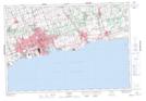
Maps showing Gold Point, Ontario, Ontario
Gold Point is a Cape located in Ontario, Ontario and has an elevation of 77 meters.
- Latitude: 43° 51' 2'' North (decimal: 43.8505555)
- Longitude: 78° 52' 11'' West (decimal: -78.8697222)
- Topography Feature Category: Cape
- Geographical Feature: Point
- Canadian Province/Territory: Ontario
- Elevation: 77 meters
- Location: Ontario
- Atlas of Canada Locator Map: Gold Point
- GPS Coordinate Locator Map: Gold Point Lat/Long