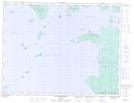
Maps showing Gorda Island, Ontario
Gorda Island is a Island located in Ontario and has an elevation of 275 meters.
- Latitude: 49° 52' 52'' North (decimal: 49.8810999)
- Longitude: 88° 25' 8'' West (decimal: -88.4188999)
- Topography Feature Category: Island
- Geographical Feature: Island
- Canadian Province/Territory: Ontario
- Elevation: 275 meters
- GPS Coordinate Locator Map: Gorda Island Lat/Long
Gorda Island NTS Map Sheets