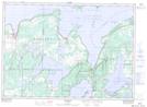
Maps showing Gorrel Point, Manitoulin, Ontario
Gorrel Point is a Cape located in Manitoulin, Ontario and has an elevation of 195 meters.
- Latitude: 45° 56' 35'' North (decimal: 45.9430555)
- Longitude: 82° 26' 52'' West (decimal: -82.4477777)
- Topography Feature Category: Cape
- Geographical Feature: Point
- Canadian Province/Territory: Ontario
- Elevation: 195 meters
- Location: Manitoulin
- Atlas of Canada Locator Map: Gorrel Point
- GPS Coordinate Locator Map: Gorrel Point Lat/Long