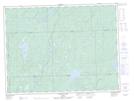
Maps showing Gourlay, Algoma, Ontario
Gourlay is a Geographical area located in Algoma, Ontario.
- Latitude: 48° 51' 45'' North (decimal: 48.8625000)
- Longitude: 84° 53' 44'' West (decimal: -84.8955555)
- Topography Feature Category: Geographical area
- Geographical Feature: Geographic Township
- Canadian Province/Territory: Ontario
- Location: Algoma
- Atlas of Canada Locator Map: Gourlay
- GPS Coordinate Locator Map: Gourlay Lat/Long
Gourlay NTS Map Sheets