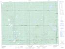
Maps showing Gourlay Creek, Cochrane, Ontario
Gourlay Creek is a River located in Cochrane, Ontario.
- Latitude: 48° 19' 20'' North (decimal: 48.3222222)
- Longitude: 79° 56' 37'' West (decimal: -79.9436111)
- Topography Feature Category: River
- Geographical Feature: Creek
- Canadian Province/Territory: Ontario
- Location: Cochrane
- Atlas of Canada Locator Map: Gourlay Creek
- GPS Coordinate Locator Map: Gourlay Creek Lat/Long
Gourlay Creek NTS Map Sheets