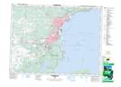
Maps showing Grand Reef, Thunder Bay, Ontario
Grand Reef is a Shoal located in Thunder Bay, Ontario.
- Latitude: 48° 18' 44'' North (decimal: 48.3122222)
- Longitude: 89° 11' 1'' West (decimal: -89.1836111)
- Topography Feature Category: Shoal
- Geographical Feature: Reef
- Canadian Province/Territory: Ontario
- Location: Thunder Bay
- Atlas of Canada Locator Map: Grand Reef
- GPS Coordinate Locator Map: Grand Reef Lat/Long
Grand Reef NTS Map Sheets