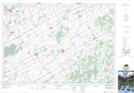
Maps showing Grantley, Dundas; Stormont, Ontario
Grantley is a Unincorporated area located in Dundas; Stormont, Ontario and has an elevation of 86 meters.
- Latitude: 45° 4' 41'' North (decimal: 45.0780555)
- Longitude: 75° 9' 4'' West (decimal: -75.1511111)
- Topography Feature Category: Unincorporated area
- Geographical Feature: Dispersed Rural Community
- Canadian Province/Territory: Ontario
- Elevation: 86 meters
- Location: Dundas; Stormont
- Atlas of Canada Locator Map: Grantley
- GPS Coordinate Locator Map: Grantley Lat/Long