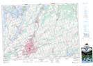
Maps showing Grape Island, Ontario
Grape Island is a Island located in Ontario.
- Latitude: 44° 26' North (decimal: 44.4333000)
- Longitude: 78° 29' West (decimal: -78.4832999)
- Topography Feature Category: Island
- Geographical Feature: Island
- Canadian Province/Territory: Ontario
- GPS Coordinate Locator Map: Grape Island Lat/Long
Grape Island NTS Map Sheets