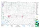
Maps showing Grape Run, Kent; Lambton, Ontario
Grape Run is a Channel located in Kent; Lambton, Ontario and has an elevation of 180 meters.
- Latitude: 42° 37' 25'' North (decimal: 42.6236111)
- Longitude: 82° 28' 48'' West (decimal: -82.4799999)
- Topography Feature Category: Channel
- Geographical Feature: Run
- Canadian Province/Territory: Ontario
- Elevation: 180 meters
- Location: Kent; Lambton
- Atlas of Canada Locator Map: Grape Run
- GPS Coordinate Locator Map: Grape Run Lat/Long
Grape Run NTS Map Sheets