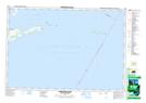
Maps showing Gravelly Point, Prince Edward, Ontario
Gravelly Point is a Cape located in Prince Edward, Ontario and has an elevation of 76 meters.
- Latitude: 43° 54' 51'' North (decimal: 43.9141666)
- Longitude: 76° 56' 22'' West (decimal: -76.9394444)
- Topography Feature Category: Cape
- Geographical Feature: Point
- Canadian Province/Territory: Ontario
- Elevation: 76 meters
- Location: Prince Edward
- Atlas of Canada Locator Map: Gravelly Point
- GPS Coordinate Locator Map: Gravelly Point Lat/Long
Gravelly Point NTS Map Sheets