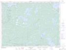
Maps showing Grey Trout Lake, Kenora; Rainy River, Ontario
Grey Trout Lake is a Lake located in Kenora; Rainy River, Ontario and has an elevation of 439 meters.
- Latitude: 49° 1' 29'' North (decimal: 49.0247222)
- Longitude: 92° 5' 2'' West (decimal: -92.0838888)
- Topography Feature Category: Lake
- Geographical Feature: Lake
- Canadian Province/Territory: Ontario
- Elevation: 439 meters
- Location: Kenora; Rainy River
- Atlas of Canada Locator Map: Grey Trout Lake
- GPS Coordinate Locator Map: Grey Trout Lake Lat/Long
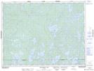
Grey Trout Lake NTS Map Sheets