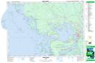
Maps showing Grouse Lake, Parry Sound, Ontario
Grouse Lake is a Lake located in Parry Sound, Ontario and has an elevation of 191 meters.
- Latitude: 45° 29' 55'' North (decimal: 45.4986111)
- Longitude: 80° 22' 3'' West (decimal: -80.3674999)
- Topography Feature Category: Lake
- Geographical Feature: Lake
- Canadian Province/Territory: Ontario
- Elevation: 191 meters
- Location: Parry Sound
- Atlas of Canada Locator Map: Grouse Lake
- GPS Coordinate Locator Map: Grouse Lake Lat/Long
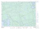
Grouse Lake NTS Map Sheets