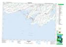
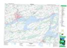
Maps showing Hallowell, Prince Edward, Ontario
Hallowell is a Geographical area located in Prince Edward, Ontario.
- Latitude: 43° 57' 59'' North (decimal: 43.9663888)
- Longitude: 77° 11' 58'' West (decimal: -77.1994444)
- Topography Feature Category: Geographical area
- Geographical Feature: Geographic Township
- Canadian Province/Territory: Ontario
- Location: Prince Edward
- Atlas of Canada Locator Map: Hallowell
- GPS Coordinate Locator Map: Hallowell Lat/Long
Hallowell NTS Map Sheets