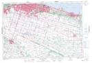
Maps showing Harmony Hall II, Wentworth, Ontario
Harmony Hall II is a Unincorporated area located in Wentworth, Ontario and has an elevation of 242 meters.
- Latitude: 43° 12' 47'' North (decimal: 43.2130555)
- Longitude: 79° 57' 43'' West (decimal: -79.9619444)
- Topography Feature Category: Unincorporated area
- Geographical Feature: Urban Community
- Canadian Province/Territory: Ontario
- Elevation: 242 meters
- Location: Wentworth
- Atlas of Canada Locator Map: Harmony Hall II
- GPS Coordinate Locator Map: Harmony Hall II Lat/Long
Harmony Hall II NTS Map Sheets