Maps showing Harris Bay, Renfrew; Hastings, Ontario
Harris Bay is a Bay located in Renfrew; Hastings, Ontario and has an elevation of 313 meters.
- Latitude: 45° 23' 26'' North (decimal: 45.3905555)
- Longitude: 77° 49' 46'' West (decimal: -77.8294444)
- Topography Feature Category: Bay
- Geographical Feature: Bay
- Canadian Province/Territory: Ontario
- Elevation: 313 meters
- Location: Renfrew; Hastings
- Atlas of Canada Locator Map: Harris Bay
- GPS Coordinate Locator Map: Harris Bay Lat/Long
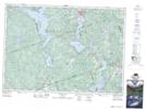
Harris Bay NTS Map Sheets