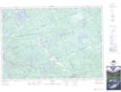
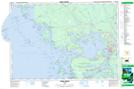
Maps showing Harris Lake, Parry Sound, Ontario
Harris Lake is a Lake located in Parry Sound, Ontario and has an elevation of 243 meters.
- Latitude: 45° 28' 36'' North (decimal: 45.4766666)
- Longitude: 79° 59' 17'' West (decimal: -79.9880555)
- Topography Feature Category: Lake
- Geographical Feature: Lake
- Canadian Province/Territory: Ontario
- Elevation: 243 meters
- Location: Parry Sound
- Atlas of Canada Locator Map: Harris Lake
- GPS Coordinate Locator Map: Harris Lake Lat/Long
Harris Lake NTS Map Sheets