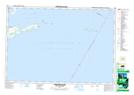
Maps showing Harris Shoal, Prince Edward, Ontario
Harris Shoal is a Shoal located in Prince Edward, Ontario.
- Latitude: 43° 55' 50'' North (decimal: 43.9305555)
- Longitude: 76° 44' 19'' West (decimal: -76.7386111)
- Topography Feature Category: Shoal
- Geographical Feature: Shoal
- Canadian Province/Territory: Ontario
- Location: Prince Edward
- Atlas of Canada Locator Map: Harris Shoal
- GPS Coordinate Locator Map: Harris Shoal Lat/Long
Harris Shoal NTS Map Sheets