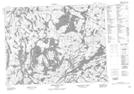
Maps showing Harvey, Thunder Bay, Ontario
Harvey is a Unincorporated area located in Thunder Bay, Ontario and has an elevation of 418 meters.
- Latitude: 50° 14' 35'' North (decimal: 50.2430555)
- Longitude: 90° 24' 55'' West (decimal: -90.4152777)
- Topography Feature Category: Unincorporated area
- Geographical Feature: Railway Point
- Canadian Province/Territory: Ontario
- Elevation: 418 meters
- Location: Thunder Bay
- Atlas of Canada Locator Map: Harvey
- GPS Coordinate Locator Map: Harvey Lat/Long
Harvey NTS Map Sheets