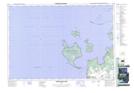
Maps showing Hayter Point, Ontario
Hayter Point is a Cape located in Ontario.
- Latitude: 44° 50' 20'' North (decimal: 44.8389000)
- Longitude: 80° 14' 29'' West (decimal: -80.2414000)
- Topography Feature Category: Cape
- Geographical Feature: Point
- Canadian Province/Territory: Ontario
- GPS Coordinate Locator Map: Hayter Point Lat/Long
Hayter Point NTS Map Sheets