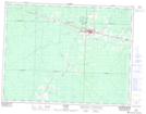
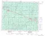
Maps showing Hearst, Cochrane, Ontario
Hearst is a Town located in Cochrane, Ontario and has an elevation of 244 meters.
- Latitude: 49° 41' 13'' North (decimal: 49.6869444)
- Longitude: 83° 39' 16'' West (decimal: -83.6544444)
- Topography Feature Category: Town
- Geographical Feature: Town
- Canadian Province/Territory: Ontario
- Elevation: 244 meters
- Location: Cochrane
- Atlas of Canada Locator Map: Hearst
- GPS Coordinate Locator Map: Hearst Lat/Long