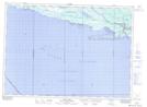
Maps showing Heather, Algoma, Ontario
Heather is a Unincorporated area located in Algoma, Ontario.
- Latitude: 46° 12' 10'' North (decimal: 46.2027777)
- Longitude: 83° 3' 59'' West (decimal: -83.0663888)
- Topography Feature Category: Unincorporated area
- Geographical Feature: Railway Point
- Canadian Province/Territory: Ontario
- Location: Algoma
- Atlas of Canada Locator Map: Heather
- GPS Coordinate Locator Map: Heather Lat/Long
Heather NTS Map Sheets