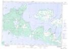
Maps showing Helen Bay, Manitoulin, Ontario
Helen Bay is a Bay located in Manitoulin, Ontario and has an elevation of 176 meters.
- Latitude: 45° 50' 28'' North (decimal: 45.8411111)
- Longitude: 82° 37' 59'' West (decimal: -82.6330555)
- Topography Feature Category: Bay
- Geographical Feature: Bay
- Canadian Province/Territory: Ontario
- Elevation: 176 meters
- Location: Manitoulin
- Atlas of Canada Locator Map: Helen Bay
- GPS Coordinate Locator Map: Helen Bay Lat/Long
Helen Bay NTS Map Sheets