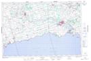
Maps showing Hemlock Creek, Haldimand, Ontario
Hemlock Creek is a River located in Haldimand, Ontario and has an elevation of 187 meters.
- Latitude: 42° 51' 11'' North (decimal: 42.8530555)
- Longitude: 79° 55' 8'' West (decimal: -79.9188888)
- Topography Feature Category: River
- Geographical Feature: Creek
- Canadian Province/Territory: Ontario
- Elevation: 187 meters
- Location: Haldimand
- Atlas of Canada Locator Map: Hemlock Creek
- GPS Coordinate Locator Map: Hemlock Creek Lat/Long