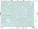
Maps showing Hemlock Island, Rainy River, Ontario
Hemlock Island is a Island located in Rainy River, Ontario and has an elevation of 358 meters.
- Latitude: 49° 0' 53'' North (decimal: 49.0147222)
- Longitude: 93° 29' 27'' West (decimal: -93.4908333)
- Topography Feature Category: Island
- Geographical Feature: Island
- Canadian Province/Territory: Ontario
- Elevation: 358 meters
- Location: Rainy River
- Atlas of Canada Locator Map: Hemlock Island
- GPS Coordinate Locator Map: Hemlock Island Lat/Long