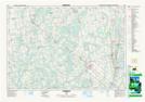
Maps showing Hemstock Mills, Grey, Ontario
Hemstock Mills is a Unincorporated area located in Grey, Ontario and has an elevation of 275 meters.
- Latitude: 44° 25' 30'' North (decimal: 44.4249999)
- Longitude: 80° 55' 11'' West (decimal: -80.9197222)
- Topography Feature Category: Unincorporated area
- Geographical Feature: Locality
- Canadian Province/Territory: Ontario
- Elevation: 275 meters
- Location: Grey
- Atlas of Canada Locator Map: Hemstock Mills
- GPS Coordinate Locator Map: Hemstock Mills Lat/Long
Hemstock Mills NTS Map Sheets