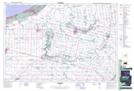
Maps showing Hickory Corner, Middlesex, Ontario
Hickory Corner is a Unincorporated area located in Middlesex, Ontario and has an elevation of 244 meters.
- Latitude: 43° 0' 19'' North (decimal: 43.0052777)
- Longitude: 81° 33' 22'' West (decimal: -81.5561111)
- Topography Feature Category: Unincorporated area
- Geographical Feature: Dispersed Rural Community
- Canadian Province/Territory: Ontario
- Elevation: 244 meters
- Location: Middlesex
- Atlas of Canada Locator Map: Hickory Corner
- GPS Coordinate Locator Map: Hickory Corner Lat/Long