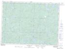
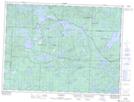
Maps showing Highbrush Lake, Sudbury, Ontario
Highbrush Lake is a Lake located in Sudbury, Ontario and has an elevation of 439 meters.
- Latitude: 47° 45' 10'' North (decimal: 47.7527777)
- Longitude: 83° 32' 51'' West (decimal: -83.5475000)
- Topography Feature Category: Lake
- Geographical Feature: Lake
- Canadian Province/Territory: Ontario
- Elevation: 439 meters
- Location: Sudbury
- Atlas of Canada Locator Map: Highbrush Lake
- GPS Coordinate Locator Map: Highbrush Lake Lat/Long
Highbrush Lake NTS Map Sheets