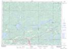
Maps showing High Falls, Sudbury, Ontario
High Falls is a Unincorporated area located in Sudbury, Ontario and has an elevation of 228 meters.
- Latitude: 46° 22' 45'' North (decimal: 46.3791666)
- Longitude: 81° 34' 14'' West (decimal: -81.5705555)
- Topography Feature Category: Unincorporated area
- Geographical Feature: Locality
- Canadian Province/Territory: Ontario
- Elevation: 228 meters
- Location: Sudbury
- Atlas of Canada Locator Map: High Falls
- GPS Coordinate Locator Map: High Falls Lat/Long