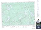
Maps showing Highland Grove, Haliburton, Ontario
Highland Grove is a Unincorporated area located in Haliburton, Ontario and has an elevation of 416 meters.
- Latitude: 45° 4' 18'' North (decimal: 45.0716666)
- Longitude: 78° 5' 14'' West (decimal: -78.0872222)
- Topography Feature Category: Unincorporated area
- Geographical Feature: Compact Rural Community
- Canadian Province/Territory: Ontario
- Elevation: 416 meters
- Location: Haliburton
- Atlas of Canada Locator Map: Highland Grove
- GPS Coordinate Locator Map: Highland Grove Lat/Long
Highland Grove NTS Map Sheets