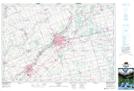
Maps showing Hodges Pond, Oxford, Ontario
Hodges Pond is a Lake located in Oxford, Ontario and has an elevation of 298 meters.
- Latitude: 43° 5' 9'' North (decimal: 43.0858333)
- Longitude: 80° 44' 14'' West (decimal: -80.7372222)
- Topography Feature Category: Lake
- Geographical Feature: Pond
- Canadian Province/Territory: Ontario
- Elevation: 298 meters
- Location: Oxford
- Atlas of Canada Locator Map: Hodges Pond
- GPS Coordinate Locator Map: Hodges Pond Lat/Long
Hodges Pond NTS Map Sheets