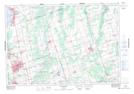
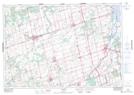
Maps showing Holland Marsh, York; Simcoe, Ontario
Holland Marsh is a Low vegetation located in York; Simcoe, Ontario and has an elevation of 237 meters.
- Latitude: 44° 9' 54'' North (decimal: 44.1650000)
- Longitude: 79° 30' 56'' West (decimal: -79.5155555)
- Topography Feature Category: Low vegetation
- Geographical Feature: Marsh
- Canadian Province/Territory: Ontario
- Elevation: 237 meters
- Location: York; Simcoe
- Atlas of Canada Locator Map: Holland Marsh
- GPS Coordinate Locator Map: Holland Marsh Lat/Long
Holland Marsh NTS Map Sheets