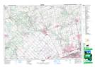
Maps showing Holly Park, York, Ontario
Holly Park is a Unincorporated area located in York, Ontario and has an elevation of 268 meters.
- Latitude: 43° 55' 41'' North (decimal: 43.9280555)
- Longitude: 79° 42' 33'' West (decimal: -79.7091666)
- Topography Feature Category: Unincorporated area
- Geographical Feature: Locality
- Canadian Province/Territory: Ontario
- Elevation: 268 meters
- Location: York
- Atlas of Canada Locator Map: Holly Park
- GPS Coordinate Locator Map: Holly Park Lat/Long