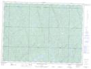
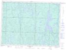
Maps showing Honey Creek, Sudbury, Ontario
Honey Creek is a River located in Sudbury, Ontario and has an elevation of 448 meters.
- Latitude: 47° 14' 19'' North (decimal: 47.2386109)
- Longitude: 83° 17' 45'' West (decimal: -83.2958333)
- Topography Feature Category: River
- Geographical Feature: Creek
- Canadian Province/Territory: Ontario
- Elevation: 448 meters
- Location: Sudbury
- Atlas of Canada Locator Map: Honey Creek
- GPS Coordinate Locator Map: Honey Creek Lat/Long
Honey Creek NTS Map Sheets