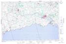
Maps showing Hoover Point, Haldimand, Ontario
Hoover Point is a Cape located in Haldimand, Ontario and has an elevation of 176 meters.
- Latitude: 42° 48' 57'' North (decimal: 42.8158333)
- Longitude: 79° 53' 28'' West (decimal: -79.8911111)
- Topography Feature Category: Cape
- Geographical Feature: Point
- Canadian Province/Territory: Ontario
- Elevation: 176 meters
- Location: Haldimand
- Atlas of Canada Locator Map: Hoover Point
- GPS Coordinate Locator Map: Hoover Point Lat/Long