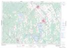
Maps showing Hopetown, Lanark, Ontario
Hopetown is a Unincorporated area located in Lanark, Ontario and has an elevation of 179 meters.
- Latitude: 45° 4' 51'' North (decimal: 45.0808333)
- Longitude: 76° 26' 34'' West (decimal: -76.4427777)
- Topography Feature Category: Unincorporated area
- Geographical Feature: Compact Rural Community
- Canadian Province/Territory: Ontario
- Elevation: 179 meters
- Location: Lanark
- Atlas of Canada Locator Map: Hopetown
- GPS Coordinate Locator Map: Hopetown Lat/Long
Hopetown NTS Map Sheets