Maps showing Howe Island, Frontenac, Ontario
Howe Island is a Geographical area located in Frontenac, Ontario.
- Latitude: 44° 16' 45'' North (decimal: 44.2791666)
- Longitude: 76° 16' 21'' West (decimal: -76.2724999)
- Topography Feature Category: Geographical area
- Geographical Feature: Geographic Township
- Canadian Province/Territory: Ontario
- Location: Frontenac
- Atlas of Canada Locator Map: Howe Island
- GPS Coordinate Locator Map: Howe Island Lat/Long
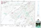
Howe Island NTS Map Sheets