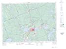
Maps showing Hunters Bay, Muskoka, Ontario
Hunters Bay is a Bay located in Muskoka, Ontario and has an elevation of 296 meters.
- Latitude: 45° 19' 26'' North (decimal: 45.3238888)
- Longitude: 79° 14' 1'' West (decimal: -79.2336111)
- Topography Feature Category: Bay
- Geographical Feature: Bay
- Canadian Province/Territory: Ontario
- Elevation: 296 meters
- Location: Muskoka
- Atlas of Canada Locator Map: Hunters Bay
- GPS Coordinate Locator Map: Hunters Bay Lat/Long
Hunters Bay NTS Map Sheets