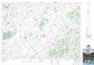
Maps showing Hyndmans Ridge, Dundas, Ontario
Hyndmans Ridge is a Mountain located in Dundas, Ontario and has an elevation of 90 meters.
- Latitude: 45° 3' 6'' North (decimal: 45.0516666)
- Longitude: 75° 30' 11'' West (decimal: -75.5030555)
- Topography Feature Category: Mountain
- Geographical Feature: Ridge
- Canadian Province/Territory: Ontario
- Elevation: 90 meters
- Location: Dundas
- Atlas of Canada Locator Map: Hyndmans Ridge
- GPS Coordinate Locator Map: Hyndmans Ridge Lat/Long
Hyndmans Ridge NTS Map Sheets