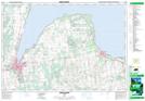
Maps showing Indian Falls, Grey, Ontario
Indian Falls is a Falls located in Grey, Ontario and has an elevation of 186 meters.
- Latitude: 44° 37' 16'' North (decimal: 44.6211111)
- Longitude: 80° 57' 17'' West (decimal: -80.9547222)
- Topography Feature Category: Falls
- Geographical Feature: Falls
- Canadian Province/Territory: Ontario
- Elevation: 186 meters
- Location: Grey
- Atlas of Canada Locator Map: Indian Falls
- GPS Coordinate Locator Map: Indian Falls Lat/Long
Indian Falls NTS Map Sheets