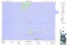
Maps showing Indian Harbour Point, Manitoulin, Ontario
Indian Harbour Point is a Cape located in Manitoulin, Ontario and has an elevation of 177 meters.
- Latitude: 45° 26' 31'' North (decimal: 45.4419444)
- Longitude: 81° 47' 54'' West (decimal: -81.7983333)
- Topography Feature Category: Cape
- Geographical Feature: Point
- Canadian Province/Territory: Ontario
- Elevation: 177 meters
- Location: Manitoulin
- Atlas of Canada Locator Map: Indian Harbour Point
- GPS Coordinate Locator Map: Indian Harbour Point Lat/Long
Indian Harbour Point NTS Map Sheets