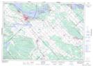
Maps showing Indian Hill, Lanark, Ontario
Indian Hill is a Mountain located in Lanark, Ontario and has an elevation of 96 meters.
- Latitude: 45° 18' 4'' North (decimal: 45.3011111)
- Longitude: 76° 17' 8'' West (decimal: -76.2855555)
- Topography Feature Category: Mountain
- Geographical Feature: Hill
- Canadian Province/Territory: Ontario
- Elevation: 96 meters
- Location: Lanark
- Atlas of Canada Locator Map: Indian Hill
- GPS Coordinate Locator Map: Indian Hill Lat/Long