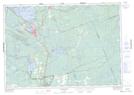
Maps showing Indian Landing, Muskoka, Ontario
Indian Landing is a Marine navigation feature located in Muskoka, Ontario and has an elevation of 234 meters.
- Latitude: 44° 53' 50'' North (decimal: 44.8972222)
- Longitude: 79° 24' 27'' West (decimal: -79.4074999)
- Topography Feature Category: Marine navigation feature
- Geographical Feature: Landing
- Canadian Province/Territory: Ontario
- Elevation: 234 meters
- Location: Muskoka
- Atlas of Canada Locator Map: Indian Landing
- GPS Coordinate Locator Map: Indian Landing Lat/Long
Indian Landing NTS Map Sheets