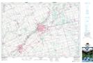
Maps showing Ingersoll, Oxford, Ontario
Ingersoll is a Town located in Oxford, Ontario and has an elevation of 274 meters.
- Latitude: 43° 2' 26'' North (decimal: 43.0405555)
- Longitude: 80° 52' 26'' West (decimal: -80.8738888)
- Topography Feature Category: Town
- Geographical Feature: Town
- Canadian Province/Territory: Ontario
- Elevation: 274 meters
- Location: Oxford
- Atlas of Canada Locator Map: Ingersoll
- GPS Coordinate Locator Map: Ingersoll Lat/Long
Ingersoll NTS Map Sheets