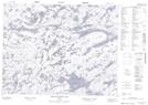
Maps showing Iriam Creek, Kenora, Ontario
Iriam Creek is a River located in Kenora, Ontario.
- Latitude: 50° 47' 29'' North (decimal: 50.7913888)
- Longitude: 94° 26' 5'' West (decimal: -94.4347222)
- Topography Feature Category: River
- Geographical Feature: Creek
- Canadian Province/Territory: Ontario
- Location: Kenora
- Atlas of Canada Locator Map: Iriam Creek
- GPS Coordinate Locator Map: Iriam Creek Lat/Long
Iriam Creek NTS Map Sheets