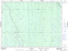
Maps showing Island Falls, Cochrane, Ontario
Island Falls is a Unincorporated area located in Cochrane, Ontario.
- Latitude: 49° 32' North (decimal: 49.5332999)
- Longitude: 81° 21' West (decimal: -81.3499999)
- Topography Feature Category: Unincorporated area
- Geographical Feature: Railway Point
- Canadian Province/Territory: Ontario
- Location: Cochrane
- GPS Coordinate Locator Map: Island Falls Lat/Long
Island Falls NTS Map Sheets