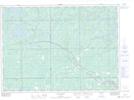
Maps showing Island Portage, Nipissing, Ontario
Island Portage is a Road feature located in Nipissing, Ontario and has an elevation of 288 meters.
- Latitude: 46° 39' 25'' North (decimal: 46.6569444)
- Longitude: 80° 4' 40'' West (decimal: -80.0777777)
- Topography Feature Category: Road feature
- Geographical Feature: Portage
- Canadian Province/Territory: Ontario
- Elevation: 288 meters
- Location: Nipissing
- Atlas of Canada Locator Map: Island Portage
- GPS Coordinate Locator Map: Island Portage Lat/Long