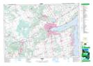
Maps showing Ivy, Simcoe, Ontario
Ivy is a Unincorporated area located in Simcoe, Ontario and has an elevation of 269 meters.
- Latitude: 44° 17' 17'' North (decimal: 44.2880555)
- Longitude: 79° 46' 28'' West (decimal: -79.7744444)
- Topography Feature Category: Unincorporated area
- Geographical Feature: Dispersed Rural Community
- Canadian Province/Territory: Ontario
- Elevation: 269 meters
- Location: Simcoe
- Atlas of Canada Locator Map: Ivy
- GPS Coordinate Locator Map: Ivy Lat/Long