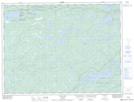
Maps showing Jackfish Hole, Rainy River, Ontario
Jackfish Hole is a Lake located in Rainy River, Ontario and has an elevation of 427 meters.
- Latitude: 48° 42' 57'' North (decimal: 48.7158333)
- Longitude: 92° 4' 8'' West (decimal: -92.0688888)
- Topography Feature Category: Lake
- Geographical Feature: Lake
- Canadian Province/Territory: Ontario
- Elevation: 427 meters
- Location: Rainy River
- Atlas of Canada Locator Map: Jackfish Hole
- GPS Coordinate Locator Map: Jackfish Hole Lat/Long
Jackfish Hole NTS Map Sheets