Canada Topographic Maps

Jericho Creek Topo Maps

Topography maps and Latitude/Longitude Location

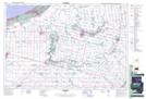
Maps showing Jericho Creek, Ontario

Jericho Creek is a River located in Ontario.

  • Latitude: 43° 12' 32'' North   (decimal: 43.2089000)
  • Longitude: 81° 54' 2'' West   (decimal: -81.9005999)
  • Topography Feature Category: River
  • Geographical Feature: Creek
  • Canadian Province/Territory: Ontario
  • GPS Coordinate Locator Map: Jericho Creek Lat/Long

Jericho Creek NTS Map Sheets

040P04 Parkhill Topographic Map at 1:50,000 scale

040P Kitchener Topographic Map at 1:250,000 scale

 
Buy Topographic Maps DVD
Newsletter Sign-up

Yes, I want to receive map store discounts.


Bookmark and Share