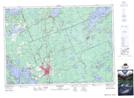
Maps showing Jibilto Shoal, Muskoka, Ontario
Jibilto Shoal is a Shoal located in Muskoka, Ontario.
- Latitude: 45° 4' 32'' North (decimal: 45.0755555)
- Longitude: 79° 29' 38'' West (decimal: -79.4938888)
- Topography Feature Category: Shoal
- Geographical Feature: Shoal
- Canadian Province/Territory: Ontario
- Location: Muskoka
- Atlas of Canada Locator Map: Jibilto Shoal
- GPS Coordinate Locator Map: Jibilto Shoal Lat/Long
Jibilto Shoal NTS Map Sheets